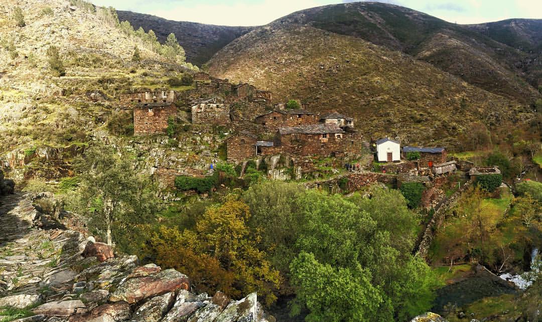
Drave is an uninhabited village located at 600 m of altitude, in a mountain valley between the Freita, São Macário and Arada mountain ranges, within the Arouca Geopark, and its first recorded mention dates back to the reign of King Dinis. It is a traditional village where the houses are made of stone, known as pedra lousinha, with schist roofs, and where three rivers meet.
The village is off the grid, and it has not changed much since the last habitants left. The nearest village, Regoufe, is 4 kilometres away and Drave is lacking electricity, sanitation, postal service or car access and the cell service, is very limited.
Origins and History
The oldest document in which Drave is mentioned is the Inquirição dos Reguengos da Beira, from the reign of King Dinis (1279–1325).
The village is isolated and shows no signs of modernity: it is not accessible by car. It has no electricity, piped water, sanitation, gas, or postal service, and mobile phone coverage is limited.
The Martins family, for whom there are records in Drave dating back to 1700, was one of the village’s largest families and also the last to leave, in 2000.
They still gather every year for the Feast of Nossa Senhora da Saúde, held on 15 August, which continues to take place annually.
In 2003, CNE – the portuguese scout moviment – opened in Drave its Rover National Base - Base Nacional da IV (BNIV) in portuguese - , a scout center for Rovers. Activitys like “Consciousness paths” (1992) - “Rumos da Consciência” in portuguese - “Paths of the New Man” (1993) - “Rumos do Homem Novo” in portuguese - and “Rover 2001” allowed the launch of this project. This last activity marks the beginning if the village’s reconstruction.